Showing posts with label Roads. Show all posts

Saturday, May 2, 2015

I-84 Stack Interchange

Hidden in plain view towering over Interstates 84 in Farmington, CT sits a multi-stack highway interchange never used by the public. If you thought CT Route 11 was cool you are going to love this. It was planned to be the first four stack interchange in Connecticut's history and plans reached there final details in the 60's and by 1969 when man landed on the moon the construction began. While the highway was almost completed, in 1973 issues with the MDC reservoirs in West Hartford halted all further work and the interchange was left for dead.

As of 2015 there are no plans to open the interchange that has sit dormant for more then 20 years although one of the ramps has since opened.


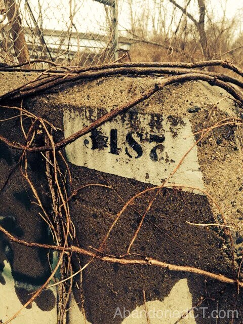
Connecticut Highway Dept. ,1963


AbandonedCT.com is a historical educational website, our videos and images are for educational purposes. Website Images, text and video posted on this website are property of Abandoned CT or its respected owners as marked and protected by Copyright law. The date photos and video are posted to this website does not necessarily represent the time they are taken or filmed. AbandonedCT.com does not release addresses of documented locations out of respect and safety of the property owner. We do not encourage or condone trespassing, reckless and unsafe exploring or vandalizing of any properties.

Share your experiences in the comments bellow! 

Sunday, November 16, 2014

CT Route 11

In Eastern Connecticut sits an under funded, deserted, and unfinished highway that goes by the official name of CT Route 11. While traveling this road to nowhere it is almost certain you will be alone with no fear of rush hour traffic. Originally proposed to be a direct route from Colchester to Interstate 95, this indirect Route drops you off in the small town of Salem. The year 1972 was the last year of construction leaving a half finished highway with a large unpaved portion complete with carved mountains, two overpass bridges and storm drains.

Plans to revive the construction have been brought up countless times over the years with proposed tolls to fund the project, but each attempt has failed.


Photo by Google Maps

Photo by Google Maps


Tuesday, January 21, 2014

Rural 169

Guest Post: submitted by Megan Anne


If you ever take a trip to the quiet corner of northeastern Connecticut, rural route 169 is the way to go. Bail on I-395 and opt for the scenic path. 169 takes you through rolling hills, farmland, forests, and historic landmarks. Along the way, there are a plethora of abandoned, grown-over buildings (but unfortunately, a number of them fall in occupied backyards.)
One of my first trips to the northeast took me past this abandoned silo. It stands out against the horizon and it’s surprisingly overgrown for being on what seems like a manicured landscape, so while someone must be taking some care of the land, the silo has failed its purpose and it’s left to rot. 
                                  

There’s nothing really haunting about it, but since there is so little traffic on 169, it can be eerily quiet. There is a dirt road off to one side but it doesn’t seem to go anywhere. That will be a trip for another day I guess. I just thought the tower stands out so perfectly against the backdrop! I’ve been by it now in every season and it’s one of my favorite 169 landmarks. 
                                   

There’s nothing interesting inside, just dust and vines now. I would imagine there must have been something else nearby that’s since grown over, like a farm or something of use. But this is all that’s left.                                     
                                              

Wednesday, August 22, 2012

Downs Road


Downs Road, located between the towns of Hamden and Bethany, Connecticut. What once was a complete route from one town to another is now an abandoned dirt road with gates blocking the entrance and exit. The remnants of foundations and rock walls are all evidence that remain of this road’s past.
We have experienced this road in both the afternoon and night. The afternoon makes for a great scenic drive through the woods with a peaceful hike thereafter. The night...well that is a different story. When we arrived on site after a long and quit spooky drive through the woods we were greeted by a long dark dirt road (Downs Road). While walking the entire stretch we heard on multiple occasions what appeared to be screaming in the distance, as well as figures appearing ahead of us on the trail. It made for one scary night. So if you are up for a good scenic drive and day hike Downs Road in the afternoon is the place for you. If you are the more adventurous thrill seeking type, the night time is what it is all about.

Be mindful of Private Property! Do not walk across peoples lawns!


Wednesday, April 18, 2012

Banton Street

Banton Street nestled between Route 15 and the Quinnipiac River from the 1920's to the early 70's, at its peak it was home to over 36 homes, Now?... Population zero. Do to upstream development over the years river flooding became too much for this community, and in 1972 the state bought the remaining homes demolishing them to the ground. Now all that remains are empty grass covered lots and plant covered curb line with the remains of building foundations.

Today a majority of Banton Street is owned by the state of Connecticut and part of the Quinnipiac River State Park. Its abandoned streets can be walked today without fear of trespassing.


Old Staircase into river
Old Driveway

Curbline


Failed Christmas Tree Garden?


Fence marking former property line